Some Thoughts on Trail Running

Combining scenery and calculated self-torture

I was breathing hard, nearly gasping, when I reached the rim of the dry bluff, slowing a little after having powered up a steep hill for about 150 yards. Sweat was running down my forehead, into my eyes and down the sides of my face. It wasn’t even noon yet, but the red sandstone boulders had absorbed their fill of solar energy which was now radiating back into the sky and back at me. It felt like I was running on a stove top, and there was no shade in sight.

A Sandy Trail in Southern Utah. Photo by ZToad.

Under any other circumstance, the soft sand would have almost been fun to cross, but now it only dragged at my feet, sinking my strides instead of pushing them forward. My leg muscles were screaming. I began to feel a growing sense of futility and the bad kind of exhaustion.  

According to my All Trails app, the trail seemed like a good fit. The elevation gain was modest and the route was well-marked and straightforward. I had parked at the trailhead, tucked inside a well-to-do neighborhood on the northwest corner of the city, pausing for a moment to read the trailhead signs and adjust my CamelBak. I sucked a bit of water and started out at a mild trot to warm up the legs and knees. But as the trail began to dramatically steepen, I found myself with a choice: I could either slow to nearly a crawl, or I could try to power my way up, basically performing a series of box jumps on the boulders intermingled with sprints through loose sand. 

I’ve always believed that good fitness involves a certain determination to put oneself through controlled punishment, so of course I chose to power my way up the hill, thinking that it would probably level out soon. But by the time I reached the rim and found the conditions already described, my heart was pounding like crazy. While working my way through the sand, I came upon a group of mountain bikers who had paused for a view. One of them looked at me and smiled in a way that seemed out of admiration or pity, I couldn’t really tell. 

“Great Job,” she said. “You’re superman.” Unable to speak, I just smiled and gave a little wave with my right hand as I huffed my way past. Of course, I gave the sand hell for another half-mile or so, trying to hold in my mind the image of the Navy Seals running on the beach and telling myself that it was only making me stronger. It worked for a time, but when the rising heat and the sand combined their full powers against me it became more than just deciding not to quit. The little alarm bell that reminds you of your mortality began to sound. Finally, I slowed down and turned back, deciding to run back downhill and use the lowland trails to finish out my miles. 

This new plan worked for the most part, except now I was no longer familiar with the route. I soon got lost on the lower trails when they turned into a labyrinth. Finally, after a flash of panic, I found the trailhead again and went back to my car. I felt defeated. Yes, it was a crazy good workout, but there was something overarching that left me questioning.      

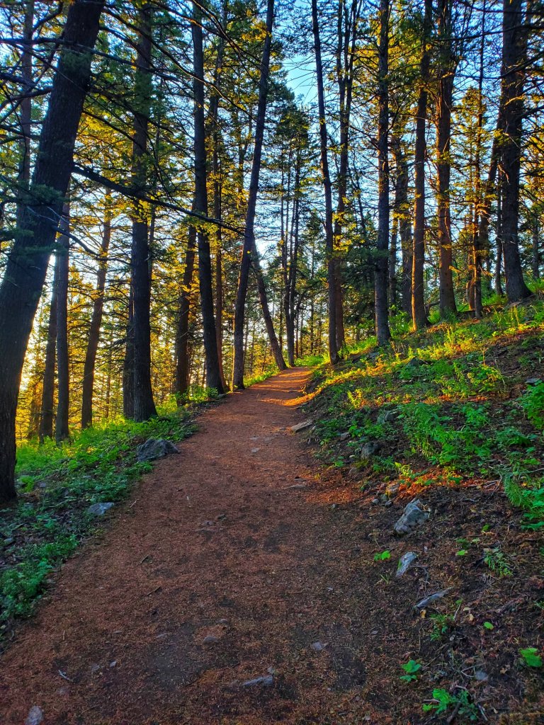
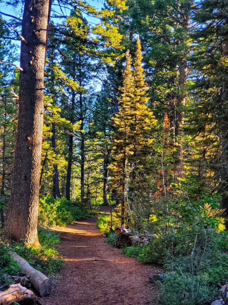
I used to think trail running was only what you did when you needed to get back to the car fast (for whatever reason, or for whatever might be chasing you). I was first introduced to the activity by an edition of Outside Magazine sometime in the 1990’s, which featured a trim-looking runner, smiling as he ran on a beautiful mountainside in Colorado. “What could be better or more brilliant than running in nature?” I thought.  

Hiking is, in and of itself, a great cardio workout, and my intention at the outset was not to replace hiking, but just to enhance the time I was already spending running by just doing it in nature. Afterall, one of the most unappealing aspects of running in general is how monotonous it can become. Slogging on a paved trail for mile after mile takes a considerable amount of mental focus and resistance to boredom. The adaptation to trail running seemed like a good solution. For the most part, it has been a good variation that has had some powerful fitness benefits. But, my experience on the bluff, among others, has taught me a few things that have kept me from thinking too highly about it.

So, if you’re considering incorporating more trail running into your routine, here are a few things I have learned: 

Disclaimer: Trail running is no joke. These are just ideas. I’m not a professional fitness expert. Consult your doctor first and use these tips at your own risk.

Have the right gear

First of all, it’s essential to have a good pair of running shoes that have already been broken in, preferably with sturdy soles and thicker padding on the sides and tops of the toes. Asics has some good options that meet this criteria. You should also consider purchasing compression sleeves or compression socks which add a circulation boost and can protect you from scrapes and scratches while passing quickly through shrubs and trees. If the weather is cooler, consider wearing running pants. 

Good running shoes and compression sleeves or socks can make a big difference. The shoes should be sturdy but comfortable and already broken in.

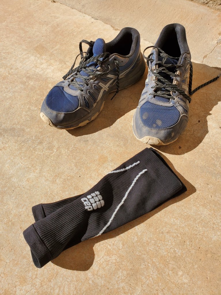
Always carry your own water. A smaller CamelBak or similar product can help you stay hydrated, and the added weight is just enough resistance to support added gains. Most CamelBaks have pockets for carrying keys and cell phones which will otherwise bounce and jangle around in your shorts when you try to run, which is very annoying. 

Plan ahead

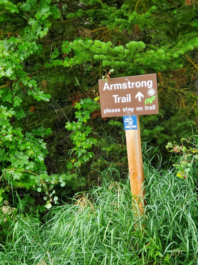
If possible, try to hike the trail beforehand on a separate day, so you’ll already know what it involves and you won’t have to think too much about navigation. Pick trails you’re familiar with. When you’re huffing and puffing, it’s easy to get carried away and forget where you’re going. Don’t rely only on trail apps or descriptions of elevation gains. Some trails seem straightforward online but they can actually get confusing very quickly, especially if you happen to miss any turn offs or cairns.

In general, avoid highly technical or rugged trails. Pick something with a considerable amount of flat land, gentle hills and smooth surfaces. Let’s face it, you just can’t run and scramble over rocks at the same time for very long. And even if you are in the amazing shape required to do so, the chance of injury will be high.   

Don’t forget to enjoy the scenery along the way. Photo by ZToad.

Be safe

Run with a friend, carry GPS or tell someone where you’re going in advance. Trail running can be more physically demanding than regular running and can put your heart, limbs and joints under more stress. Sometimes just being at higher elevations can stress the body. Having a medical emergency while alone on a trail can be life-threatening.

A special word of caution: If you choose to go running in bear country (not sure that I ever would), be especially vigilant. Go with a group, make almost constant noise and carry bear spray. A quiet, solo run through a forest is a great way to surprise a bear, or trigger a predatory response and end up in a really bad situation. Pick an area with good visibility for the most part. 

If you do decide to run alone, leave a note on your windshield telling rescuers where you’re headed. You can also leave a voicemail or send a text to a friend with a map of the trail. If you get lost, stop running. Try to wear bright clothing which makes it easier to find you in wild terrain. 

Know the weather and prepare accordingly, just like you would for hiking. In desert climates, you should avoid going out mid-day (heat exhaustion will not make you any tougher). Get up early, or go at sundown. Always wear sunglasses, sunscreen and bug spray. Nothing makes you feel like quitting quite like bugs in your eyes, or biting flies and mosquitoes on your arms and legs. I also carry a pocket knife and sometimes a short walking stick which can be used in defense and also gives your arms a good workout during the run. 

Take it easy

Trail running can get intense very quickly so you don’t need to add much to it. Always warm up first, especially your ankles and knees.

My favorite running technique is to hike the inclines and declines and run the flats. But you should know your own limits. It’s best not to run at maximum exertion. If you can still talk, you’re still getting a good workout but not overdoing it. If the trail gets rocky, slow down and pay attention to your feet. Don’t get sucked into the scenery while traversing rough terrain. It only takes a moment of looking away to end up with an ankle sprain or a trip and fall.

Pay attention to signs and be prepared for other hazards including slow hikers, fast mountain bikes and horse riders on blind curves. Stay aware of time. If you’re not running a loop, set a timer and give yourself equal time to get back. When you do reach your car, always take time to hydrate and stretch. Sitting in a driver seat right after running can make your muscles tighten and get you even more sore than you otherwise might have been.       

Trail signs can be easily overlooked while running. Don’t forget to look up.

Conclusion

Ultimately, trail running can be a fantastic exercise that can get you in pretty savage shape. But it’s not without real hazards and frustrations. No exercise goal is worth getting lost, broken, mauled, bitten or sick. A little pre-planning and preparedness will go a long way to make it a successful endeavor. And don’t forget to look up whenever you can to enjoy the scenery. Afterall, it’s really what makes trail running special. Whenever the punishment seems too much, it’s the view that just might keep you coming back.    

Ancient Trees and a Legendary Bear

Natural history and mythology share a landscape in common

I was standing beneath the branches of a centuries-old Limber pine, contemplating the accomplishment of its life and admiring its three main trunks, pointing like a trident into the sky. It was a clear August morning. Nearby, a ridgeline of knee-high grass flowed south, overlooking the azure shores of Bear Lake and the idyllic town of Garden City, where I had been staying with family for a couple of days. The contrast between the beachtown and the forest was sublime. 

The Ancient Limber Pine. Photo by ZT.

I had dropped my backpack at the foot of the tree, well aware that I was the first visitor of the day–a rare occurrence in this age of faddish recreation. While resting beneath the ancient tree, I watched the morning sunlight filter through the remaining forest, washing over treetops before percolating down to the understory. At the trailhead, I had learned that Clark’s Nutcrackers had done a lot of work here, using their wings and beaks to scatter an estimated 30,000 tree seeds across the surrounding range. 

I’d been wanting to do this hike for some time, not for physical fitness–the trail is barely over a mile long–but because the surrounding area had something in its history that called to me. This corner of the Uinta-Wasatch-Cache National Forest had a story to tell that went beyond ancient trees–it was a holdout of sorts, for the deepest kind of wilderness, where nature and mythology were intertwined.

“Old Ephraim” was the last known grizzly to roam the State of Utah. Standing ten-feet-tall on two legs and weighing over 1,100 pounds, the local shepherds called him “Three Toes,” after one of his forepaws was injured while tangled in a steel trap. Leaving his crooked print wherever he went, he wandered the mountains between Bear Lake and Logan for many years, eluding poisoned bait and bullets alike.

But the great bear finally met his end on an August night 100 years ago, when a trapper named Frank Clark, desperately looking to avenge the deaths of hundreds of sheep, finally found his chance. As Clark’s hound dogs assailed the trapped bear, he fired shots from an under-powered rifle, merely killing by degrees. Old Ephraim died slowly overnight while Clark listened and waited in the dark.    

In his story “The Bear,” William Faulkner beautifully encapsulates the simultaneous glory and emptiness of the trapper’s toil and the ferocity of his foe:  

He had already inherited then, without ever having seen it, the big old bear with one trap-ruined foot that in an area of almost a hundred square miles had earned for himself a name, a definite designation like a living man–the long legend of corncribs broken down and rifled, of shoats and grown pigs and even calves carried bodily into the woods and devoured, and traps and deadfalls overthrown and dogs mangled and slain, and shotgun and even rifle shots delivered at pointblank range yet with no more effect than so many peas blown through a tube by a child–a corridor of wreckage and destruction beginning back before the boy was born, through which sped, not fast but rather with the ruthless and irresistible deliberation of a locomotive, the shaggy tremendous shape. It ran in his knowledge before he ever saw it. It loomed and towered in his dreams before he ever saw the unaxed woods where it left its crooked print, shaggy, tremendous, red-eyed, not malevolent but just big, too big for the dogs which tried to bay it, for the horses which tried to ride it, for the men and the bullets they fired into it; too big for the very country which was its constricting scope. 

On the way to the Limber pine. Photo by ZT.

With my eyes overlooking this related country, and my mind thinking back, I felt the peculiar amalgamation of triumph and disappointment. It was still very much that ancient wilderness, but it had been changed forever, diluted and domesticated by the assault of good intentions.    

That doomed wilderness whose edges were being constantly and punily gnawed at by men with plows and axes who feared it because it was wilderness, men myriad and nameless even to one another in the land where the old bear earned a name, and through which ran not even a mortal beast but an anachronism indomitable and invincible out of an old, dead time, a phantom, epitome and apotheosis of the old, wild life which the puny humans swarmed and hacked at in a fury of abhorrence and fear, like pygmies about the ankles of a drowsing elephant,–the old bear, solitary, indomitable, and alone; widowered, childless, and absolved of mortality–old Priam, reft of his old wife, and outliving all his sons.

William Faulkner–“The Bear”

My surroundings made it easier to get lost in nostalgia. I imagined Ephraim chuffing and rooting as he might have passed beneath this same tree on a morning just like this. I was reluctantly grateful for the Boy Scouts who, at some point after Ephraim’s death, exhumed his remains and, more nobly, donated his skull to the Smithsonian and later the Utah State University. (https://en.wikipedia.org/wiki/Old_Ephraim) The donation likely helped the legend to go beyond just the back porches of sheep men and ranchers.  

My backpack still leaned against the base of the Limber at its widest point, as wide as a car. I saw other smaller and younger specimens of Limber, some “only” 200 to 300 years old, and a long-forgotten wooden railing which marked a spot where early forest managers had apparently attempted a makeshift viewing platform, probably an effort to protect the roots of the old tree, which were now partially exposed and thick as railroad ties. 

The trail leading up to the Limber had been well-groomed. I had entered the forest to the sounds of squirrels and birds echoing into the still warming air, taking the left-fork first and then climbing a fairly steep incline through shimmering fir and aspens, alternated with clumps of mountain mahogany and gamble oak.  

The trail going back held more of the same beauty. To the west, was a mosaic of treelines and clearings–good bear country that was now filled with summer sun. The trail was bright and cheerful and the rockless dirt underfoot was full of organic material, giving it a sort of sponginess that returned energy and made my footsteps light. I passed a few pines bent from years of heavy snows, one at nearly a 90 degree angle, like a chair. 

A Morning View on the Limber Pine Nature Trail. Photo by ZT.

As I rounded a bend on the western section, I came into a small clearing with a good view. Recent rains had left mud puddles and it was in one of these that something caught my eye. It was a fresh black bear track transecting the path, headed back to the east toward the Limber. By the looks of it, the bear was small, maybe even a cub from last year. But it was definitely on top of the other tracks and had likely been made within the last couple of hours. I got some photos, looked around anxiously (more so for the mother than for the cub) and continued on. 

A black bear track on the trail. Photo by ZT.

It had been a poetic, even ironic discovery. The bear print was a reassurance that the wilderness here, while profoundly changed from Ephraim’s time, was not completely lost. There was still continuity, flowing like a river between the ancient and the modern. The old tree was still holding this line in both time and legend. And it appeared that the bears, in their own way, were holding it too. 

Into the Heart of the Great Basin

A road trip to a land of surprising variety

Not long ago, we climbed into an old pickup truck and went west along one of America’s loneliest roads, passing over a roller coaster of desolate mountain ranges and endless sagebrush valleys–the forgotten floors of an ancient sea.

We were headed deep into The Great Basin, a destination that had been on my mind for some time, but not yet seriously. The goal was to spend a day or two camping and hiking in the area, to see if it was worth braving the mind-numbing travel I had heard of.

We first crossed through the small railroad town of Milford, Utah, along Highway 21, stopping briefly near a summer-vacated high school to rest in the shade. Feeling rested again, we drove on, following a ridge that quickly descended into the first of a series of deep valleys.

I wasn’t really sure what to expect, to be honest. I’d heard about the isolated west desert and could imagine it in my mind, being no stranger to arid places. But I couldn’t believe how long and straight some of the miles were, and it made the little nap at the school seem like more of a fortunate strategic decision rather than any sort of luxury. This was definitely not the place for a fatigued driver.

Highway 21 stretches west toward Baker Nevada. Photo by ZT. All rights reserved.

The bed of the truck was loaded with camping gear, and I was thankful that the air- conditioner was still working because the temperatures were pushing close to 100 degrees. Mirages floated like specters on the asphalt ahead and, at times, the simmering air made the distant trajectory of the roadway hard to discern.

While passing a place called Garrison, near the Utah state line, a lone pronghorn antelope grazed on the outskirts of a few patchy green fields, lined with clumps of ragweed. And within the next few minutes, we began to see the beacon of Wheeler Peak in the distance, standing at 13,063 feet in elevation, the second highest mountain in Nevada.

It was an incredible thought, but if Wheeler Peak were shifted a few miles east across the state line, it would still be the second highest mountain in Utah. There was something inspiring about this relatively small mountain chain standing alone, the highest for 180,000 square miles, and completely unattached to either the Sierras or the Rockies. As for the peak itself, it was named, climbed and surveyed in 1869 by Lt. George Montague Wheeler and his men. (https://www.nps.gov/grba/learn/historyculture/why-wheeler.htm)

Reaching the Park

After nearly 90 miles across the sagebrush, we reached the small town of Baker, Nevada and for the first time saw the gateway to Great Basin National Park. The scenery so far had been full of repetiton but ended with this–a close-up view of one of the most dramatic “sky islands” I had yet to experience.

We passed a single gas pump and a couple of restaurants beside a small collection of frontier homes. One restaurant had a surprising number of customers (either because it had really good food or the only food in town, I couldn’t be sure which). We saw only a few side streets that quickly trailed off into the desert, not surprising for a town with a population of less than 70.

Meanwhile, looming behind the town’s main drag, the treeless summits still harbored patches of snow. I thought about the glacier inside the park, on a protected slope– one of the southernmost of its kind in the U.S and reachable by trail. From our perspective down on the desert floor, it was hard to imagine anything like it.

The scenery so far had been full of repetition but ended with this--a close-up view of one of the most dramatic "sky islands" I had yet to experience.

At the west end of town, near the turnoff leading to Wheeler Peak, we found the first of two National Park Service visitor centers. Stopping here, we were greeted by a collection of maps and brochures along with a few freshly picked apricots leftover in a cardboard box. I learned that there was a second visitor center in the park, at nearby Lehman Caves, where the settler Absalom Lehman first planted the orchard in the 1800’s, later donating the land to the park.

An apricot tree shows off an abundance of fruit near the Lehman Caves Visitor Center. The orchard was planted in the 1800’s and has been here ever since. It is now maintained by the park service. Photo by ZT. All rights reserved.

The visitor center was cool inside, which was a welcome change. Two NPS employees worked behind plexiglass (presumably Covid precautions) at the gift counter. They confirmed to me that the park has no entrance fee, making it one of only a few in the West allowing access to whoever is willing to make the trek to see it. And it’s open 24 hours a day, 7 days a week. As for lodging, there are campsites for reservation only inside the park and limited lodging in Baker. Services in general are sparse.

After browsing some souvenirs, I glanced at a wall-sized map of the surrounding Great Basin itself, realizing just how big the overall area is–a whopping 200,000 square miles stretching across several states. The waters of the basin drain internally, creating a sort of island in its own right, not in terms of elevation, but in a hydrological sense.

“All precipitation in the region evaporates, sinks underground or flows into lakes (mostly saline). Creeks, streams, or rivers find no outlet to either the Gulf of Mexico or the Pacific Ocean.

https://www.nps.gov/grba/planyourvisit/the-great-basin.htm

While the visitor center beckoned us to stay, we weren’t here for just peripheral trivia. It was time to head up into the park and see it in a more intimate way.

Once back on the entrance road, we took the actual turnoff and began a nearly 5,000 foot ascent toward the Wheeler Peak Campground. Thankfully, despite some treacherous drop offs, the road was well-maintained and the old truck had little struggle reaching the top. While ascending, I was able to better appreciate the big skies, which were richly blue, with clouds seemingly larger than life.

Discovering an Alpine World

When we arrived at the base of Wheeler Peak, we settled into a campsite, taking some time before bed to stand in a lush meadow with a stunning view. As the light faded, we watched the high slopes trade patches of gold for a wash of blues and violets. At one point a mule deer crossed through a clearing nearby, pausing for a moment to survey the scene. It was a stunning end to a long day and we turned, reluctantly, back through the pines to our camp.

Wheeler Peak towers over a meadow at dusk. Photo by ZT. All rights reserved.

We awoke in the morning to chilly air, a distinct change from what we were acclimated to. After breakfast in the pines, we packed up camp and drove a short distance to the Alpine Lakes Loop trailhead. I’ve always had an affinity for mountain lakes and was excited to take this relatively short hike to see some of them.

We started out on the trail, crossing over a wooden bridge and taking the right fork leading to Stella Lake. The temperature was warming, but it was still perfect for hiking and the trail was well-used, but not crowded by any means.

We wandered through a series of meadows and stands of spruce, crossing over several small rivulets that flowed across the trail. The smell of pine was rich, but the climb was surprisingly steep at times and, in the high-altitude air, we had to pause often to catch our breath. Still, the best hikes are the unhurried kind, and while standing in the open areas we could feel the mountain sunlight and see the high peaks curling around us like a giant amphitheater. 

Because of this terrain, however, Stella Lake was hard to see on approach and we were just beginning to wonder if we were still on track when an older gentleman appeared from the opposite direction. By the looks of his outfit and gear, long pants, sturdy boots and a hat, he was an experienced hiker. 

“Hello,” I said, aware that not everyone wants to talk on the trail, but hoping he would. “Do you know if we’re close to Stella Lake or do we have a ways to go still?” 

“It’s actually just right there,” he said, pointing behind him and smiling.

“Okay, great. Does the loop keep climbing from there or does it level-off and head back down? I’m just wondering if we should keep going afterward or turn around and go back down.”

“You should definitely keep going,” he replied. “It mostly levels off and loops back down to the trail head, and there’s another nice lake on the way. The hardest part is behind you.” 

It’s sometimes rare to find good news on the trail. Often it seems that unexpected difficulty just has to be part of the experience. In this case, I was grateful to hear we were close and that the full loop would be the better choice. I thanked our trail friend for the intel and we continued on. 

Sure enough, after about 150 yards, we came over a hill-crest to find Stella Lake at last, hiding like an emerald, in the trees and shale. The fish were jumping and a Limber pine stood, tall and trunk-twisted, nearby. We lingered here for some time, skipping pebbles, admiring chipmunks and contemplating what a short but sweet introduction this had been. 

There was no longer any doubt that the Great Basin was full of surprises and hidden charms–small roadside towns, towering peaks still holding late summer snow, a glacier, apricot orchards, deep caves, magical alpine lakes, clear night skies and even an ancient grove of Bristlecone pines that we unfortunately had to bypass (until next time).

Even though our experience was brief, there was an overall feeling about this place that stuck with us–a beautiful consistency of contrast that was tangible enough to carry home.  

Sunset and Outstretched Arms

The path along the Virgin River was flooded a few nights ago as we surveyed the route from the top of the trailhead. Ample rains had left mud and about eight inches of water for nearly a hundred yards along the trail.  

It wasn’t exactly an impasse, just cause for pause.  We decided to press on, knowing that hiking isn’t just about sightseeing and meandering.  Sometimes there should be some struggle–some challenge to overcome.     

And, despite the mud and a few dangerous looking Chollas close to the trail, it was settling down to be a beautiful evening.  The surrounding canyon walls reflected the lowering sunlight which sparked colors among a few patches of early wildflowers and whitewashed the log jams and snags of deadwood along the floodplain.     

Joshua blooms in the Virgin River Gorge

Soon we were making our way around the dirty puddles, over higher ground, sidestepping carefully at times between creosote and a barbed wire fence.  Once back on the BLM trail headed south, my eyes raised from my feet to the skies.  All around us was the settling peace of the desert at dusk.

As I often do while hiking, I thought about the natural (and unnatural) history of the scene.  The Virgin River Gorge descends on a fairly steep grade from Southwestern Utah through the Arizona Strip and toward Las Vegas.  It’s mostly known as a route for Interstate 15, whose footprint was blasted out of the rocks in 1973 as one of the costliest projects in the history of the Interstate system. 

“The Gorge,” as it’s often called, is notorious among locals for having steep curves, brainless drivers and a seemingly never-ending barrage of construction projects.  The highway has claimed many lives over the years and has witnessed some of the most catastrophic vehicular events imaginable.  That narrow stretch of sky between canyon rims has too often ushered the passing of both smoke and souls.    

Yet, for all its treachery, the highway is nestled inside a respectable display of desert beauty.  The canyon walls, some of them hundreds of feet high, are supported by steep sloping foothills peppered with fallen boulders and hemmed by long deep ravines.  

The Gorge lies on the upper reaches of the Mojave Desert at its eastern border with the Colorado Plateau.  Accordingly, it has some of the typical vegetation of the Basin and Range Province of Nevada and California merging with the scrub and forbidding rockscapes of the higher elevations.  This meeting of biomes, as is true in other places on earth, leads to an array of biodiversity.

On this night the young grasses were greener than perhaps I’d ever seen them, thanks to several “atmospheric rivers” that have brought record amounts of rain.  Yucca, creosote, willow and the occasional barrel cactus all punctuated the slopes.  

Yet the tallest and most prominent plants were the Joshua trees, which happened to be in bloom.  Often in clusters, with spiny leaves on “outstretched” branches, they could be seen as sentinels over the landscape–that is if attaching such human characteristics can be tolerated.  

I’m not the first one to do so.  As the early pioneers described, the Joshua trees and their outstretched branches were like arms open in supplication to weary travelers of which there have been many.  For 10,000 years, in fact, people have been traveling and inhabiting the gorge.  The first were Mammoth hunters and later the Desert Culture people who lived a nomadic hunter-gatherer lifestyle here.  

Between 200 A.D. and 700 A.D., the Anasazi, part of the pueblo culture of the Colorado Plateau, carried on farming in the area.  Later the Paiutes settled and returned to a more Desert Culture lifeway.  

In 1776 two Franciscan friars, Fray Francisco Atanasio Dominguez and Sylvestre Velez de Escalante, entered the region with a small party searching for a route between New Mexico and the California missions.  Their effort fell short and they turned back to Santa Fe.

Later, in the early 1800’s, the route sought by the friars became a reality for fur trappers and Mexican traders who blazed what became known as the Old Spanish Trail.  The famous explorer Jedediah S. Smith passed through the gorge in September of 1826, followed by others like him. 

From 1830 to 1848, Mexican traders from Santa Fe and Taos took annual caravans through the area.  However, it appeared they usually made a more manageable crossing using the Beaver Dam Mountains (now the route for Old Highway 91) some 15 miles to the north.  

At about the same time as the trader caravans, the Mormons began to use the same route to connect growing communities in Utah with goods in Los Angeles.  (Courtesy BLM kiosk at Virgin River Gorge Recreation Area “A Thoroughfare of History”)  

A trailside cactus filters sunlight

There was no sign of pioneers or Franciscan friars this evening.  And thankfully we were down below the highway where modern day traders and vacationers now rumbled past.  Like hobbits sneaking toward Mordor, we pressed on while the automotive orcs marched on the pass above us.  

Sometimes we could hear the traffic, which undoubtedly diminished our peace.  But it was still possible to ignore the sounds and focus more on what the canyon really is and has been all along: the home of a river, a stairway of sorts from the high tables of red rock into the frying pan of the Mojave–a place where wildlife displays its fortitude against the elements and man.       

When we reached the riverbank, we found the trail impassable due to spring runoff.  Swift currents of brown silty water rushed downward toward Lake Mead.  While not very deep, the speed with which the water passed was enough to prevent any further travel.  

This time turning back, we followed a sandbank to the East, through stands of willow still bare from the long winter.  In the sand we saw the tracks of insects and animals.  Stink bugs, centipedes, the long rear paws and small forepaws of jackrabbits.  There was the occasional lizard track mingled with the doodles, love notes and sand castles from children who had come before.    

After returning to the trailhead, we decided to take one more hike to the top of the hill above the campground.  The blooms on the Joshua trees were more ornate here and from this vantage we could see just how tightly the highway and surrounding rock had been fit together.  

As the sun dipped below the horizon, it cast a purple light over the canyon rim.  The bats were beginning their nightly flittering, hopefully, to eat their fill.  It was an open and glowing ending to a muddy and obstructed start.  A reminder that journeys, like places, can change.  And sometimes they can be entirely different all at once.